Category: Geography

  • Flying Rivers: Amazon’s Hidden Lifelines Under Threat

    Flying Rivers: Amazon’s Hidden Lifelines Under Threat

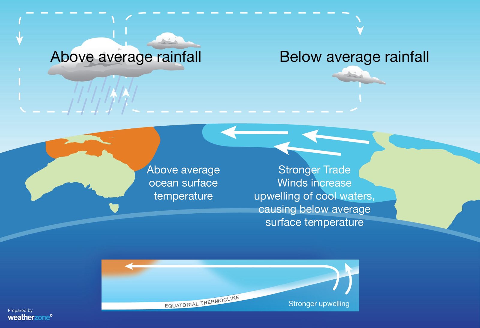
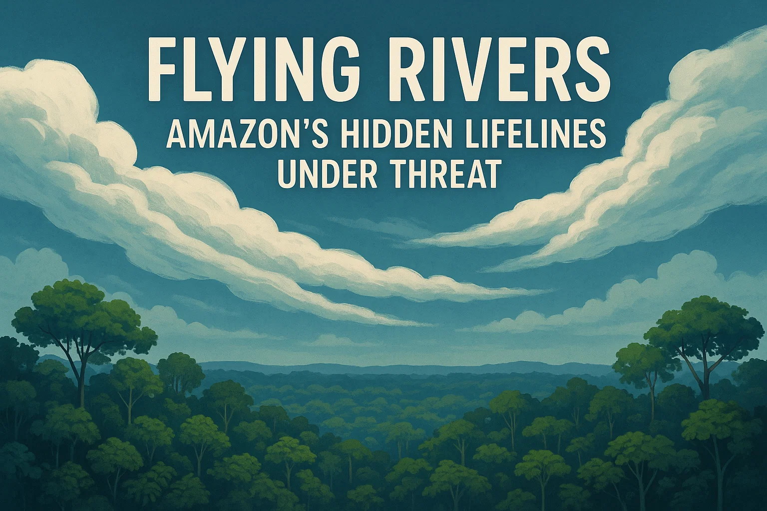
    Amazon’s flying rivers—vast aerial water currents—are weakening due to deforestation, fires, and climate change. Discover their global significance, threats, conservation efforts in South America, and lessons India can learn.

    Context

    The latest analysis by Amazon Conservation’s MAAP has revealed regions most vulnerable to the breakdown of “flying rivers” and refined scientific understanding of how the Amazon may be nearing a tipping point. These findings have sparked urgent warnings: if the Amazon’s flying rivers continue to weaken, severe droughts across South America could become the norm, with devastating impacts on people, ecosystems, and economies.

    What are Flying Rivers, and why do they matter?

    “Flying Rivers” are vast aerial streams of water vapour produced by the Amazon rainforest through evapotranspiration—the process in which trees absorb water and release it into the atmosphere.

    The Amazon’s 400 billion trees collectively release around 20 billion tonnes of water vapour every day. This vapour forms giant atmospheric currents that move westward from the Atlantic Ocean across the Amazon Basin before condensing and falling as rain across much of South America.

    These rainfall systems stabilise climate and water cycles across at least eight countries, supporting agriculture, biodiversity, and water security. They also underpin hydroelectric generation and food production in regions such as southern Peru, Bolivia, and Brazil. Without the flying rivers, these areas face a dramatic decline in rainfall, threatening millions of lives and livelihoods.

    Flying Rivers: Amazon’s Hidden Lifelines Under Threat | The Study IAS

    What is disrupting the Flying Rivers?

    Deforestation

    The Amazon has already lost 17% of its forest cover, primarily due to cattle ranching, soy cultivation, logging, and infrastructure projects such as Brazil’s controversial BR-319 highway. Fewer trees mean less transpiration and therefore less atmospheric moisture available for rainfall.

    Forest Fires and Degradation

    Widespread human-induced forest fires release aerosols that block cloud formation. Degraded forests also lose their efficiency in transpiration, weakening the Amazon’s natural “hydrological pump.”

    Climate Change

    Rising global temperatures disrupt the forest-water cycle. While higher heat increases evaporation, it also reduces soil moisture and forest transpiration capacity. The Amazon is experiencing longer dry seasons—about five weeks longer than 45 years ago—while El Niño events are becoming more frequent and intense, further suppressing rainfall.

    Land Use and Agricultural Expansion

    Large-scale monoculture farming (soy and palm oil) and urbanisation are fragmenting forests and replacing high-transpiration ecosystems with low-transpiration landscapes. This hampers vapour transport and reduces rainfall stability.

    Positive Feedback Loops

    The most worrying aspect is the feedback cycle: reduced rainfall weakens the forest, making it more vulnerable to fires and deforestation, which in turn further reduces rainfall. This vicious loop raises the risk of savannisation, where the Amazon permanently shifts from rainforest to savanna. Such a shift would release vast amounts of carbon, accelerating climate change globally.

    How are South American countries responding?

    Suriname’s Conservation Leadership

    Suriname has pledged to protect 90% of its tropical forests, far surpassing the U.N.’s “30×30” conservation goal. This bold commitment ensures that one of the most intact rainforest regions continues to act as a carbon and water regulator.

    Colombia’s Progress

    In early 2025, Colombia reported a 33% drop in deforestation compared with the same period in 2024. National parks in the Amazon region recorded particularly strong improvements, achieved through stricter law enforcement, better coordination with local communities, and joint national strategies.

    Regional Cooperation

    The eight Amazonian nations have increasingly recognised the rainforest as a shared ecosystem. They are working through alliances, declarations, and summits to jointly combat deforestation, promote sustainable development, and protect the Amazon’s ecological integrity.

    Lessons for India

    Although less studied in South Asia, atmospheric rivers play a crucial role in the Indian monsoon system and in extreme precipitation events across the Himalayas and northern India. India can draw lessons from South America in safeguarding its own forest-atmosphere-water linkages:

    1. Forest Monitoring: Develop real-time satellite surveillance beyond platforms such as Bhuvan, drawing inspiration from Brazil’s PRODES system.

    2. Community Involvement: Strengthen the rights of forest-dwelling communities under the Forest Rights Act (2006), echoing Indigenous protections in the Amazon.

    3. Recognising Forest–Climate Links: Incorporate rainfall recycling and hydrological services into forest valuation frameworks, not just carbon storage.

    4. Legal Innovations: Consider pioneering legislation to protect “ecological corridors” or even “atmospheric rivers”, ensuring the continuity of forest-water cycles.

    Conclusion

    The Amazon’s flying rivers are a lifeline not just for South America but for the planet’s climate stability. With deforestation, fires, and climate change pushing the rainforest towards a tipping point, the consequences could ripple far beyond the continent—disrupting rainfall, agriculture, and ecosystems worldwide.

    South America’s proactive efforts provide a blueprint for other nations, including India, to recognise the critical role of forests in regulating atmosphere-water cycles. Protecting these invisible rivers in the sky is as vital as conserving rivers on the ground—for without them, both climate and society may run dry.


    Subscribe to our Youtube Channel for more Valuable Content – TheStudyias

    Download the App to Subscribe to our Courses – Thestudyias

    The Source’s Authority and Ownership of the Article is Claimed By THE STUDY IAS BY MANIKANT SINGH

  • India’s Cold Desert Biosphere Reserve Wins UNESCO Recognition

    India’s Cold Desert Biosphere Reserve Wins UNESCO Recognition

    UNESCO has recognised Himachal Pradesh’s Cold Desert Biosphere Reserve as India’s 13th site in the World Network of Biosphere Reserves. Located in Lahaul-Spiti, it hosts snow leopards, ibex, rare medicinal plants, and 12,000 residents practising sustainable livelihoods. Recognition boosts conservation, eco-tourism, research, and aligns with SDG-15.

    Context

    UNESCO has recently designated Himachal Pradesh’s Cold Desert Biosphere Reserve as part of its World Network of Biosphere Reserves (WNBR). With this development, India now has 13 such reserves recognised globally, reinforcing its dedication to biodiversity conservation, climate resilience, and sustainable livelihoods.

    About the 13th Cold Desert Biosphere Reserve

    The Cold Desert Biosphere Reserve lies in the Lahaul-Spiti region of Himachal Pradesh, representing India’s first high-altitude cold desert biosphere. It spans an altitude of 3,300–6,600 metres, encompassing:

    • Pin Valley National Park

    • Kibber Wildlife Sanctuary

    • Chandratal Wildlife Sanctuary

    • Sarchu plains

    The zoning into core, buffer, and transition areas integrates conservation with local livelihood practices, aligning with India’s National Biodiversity Action Plan and Sustainable Development Goal 15 (Life on Land).

    Why Is UNESCO Recognition Significant?

    1. Global Recognition
      The designation places India’s Cold Desert on the international conservation map, ensuring better support for ecological research and sustainable development initiatives.

    2. Eco-tourism Opportunities
      Recognition opens up avenues for carefully managed eco-tourism, boosting local economies while safeguarding fragile habitats.

    3. Climate Resilience
      High-altitude cold deserts are climate-sensitive ecosystems. International collaboration under UNESCO’s Man and the Biosphere (MAB) Programme helps in devising strategies for adaptation and resilience.

    4. Integration of Local Communities
      Around 12,000 residents in the reserve practise pastoralism and barley-pea farming, with sustainable practices forming part of the management strategy. Recognition strengthens their role in community-led conservation.

    Flora of the Cold Desert

    The Cold Desert is home to unique and often rare plant species adapted to extreme conditions.

    • Willow-leaved sea-buckthorn (Hippophae salicifolia): Known for its nutritional and medicinal value.

    • 47 documented medicinal plants: Many are central to Sowa Rigpa (Amchi medicine), recognised by the Ministry of AYUSH.

    • Alpine herbs and grasses adapted to thin soils, high UV radiation, and low precipitation.

    Fauna of the Cold Desert

    The fauna reflects the resilience of life in harsh climates:

    • Snow leopard (Panthera uncia): An apex predator and a symbol of conservation in the Himalayas.

    • Himalayan ibex and blue sheep (bharal): Key prey species supporting the predator-prey balance.

    • Golden eagle: An iconic raptor adapted to the high-altitude ecosystem.

    • Other species include Tibetan wolf, red fox, and migratory birds adapted to alpine wetlands.

    These species not only hold ecological significance but also form part of cultural narratives of the region’s inhabitants.

    What Is a Cold Desert?

    A cold desert is a type of desert ecosystem found at high altitudes. Unlike hot deserts, cold deserts are shaped by glaciated valleys, wind-swept plateaus, and fragile soils. Their features include:

    • Low temperatures: Often below freezing for much of the year.

    • Scant rainfall: Less than 25 cm annually.

    • High diurnal variation: Sharp contrasts between day and night temperatures.

    • Sparse vegetation: Mainly hardy grasses, shrubs, and alpine herbs.

    Cold deserts are among the most fragile ecosystems, highly vulnerable to climate change, land-use pressures, and unsustainable tourism.

    India’s UNESCO Biosphere Reserves under MAB

    India’s Cold Desert Biosphere Reserve Wins UNESCO Recognition | The Study IAS

    India has a total of 13 biosphere reserves recognised internationally under UNESCO’s Man and the Biosphere Programme. These include:

    1. Nilgiri

    2. Nanda Devi

    3. Nokrek

    4. Great Nicobar

    5. Gulf of Mannar

    6. Manas

    7. Sunderbans

    8. Simlipal

    9. Pachmarhi

    10. Khangchendzonga

    11. Agasthyamalai

    12. Panna

    13. Cold Desert (Himachal Pradesh)

    This network reflects India’s ecological diversity—from tropical forests to high-altitude deserts.

    Achieving Balance: Conservation and Livelihoods

    The Cold Desert Biosphere Reserve highlights the synergy between conservation and development:

    • Core Zone: Strictly protected for biodiversity conservation.

    • Buffer Zone: Allows regulated research, eco-tourism, and limited resource use.

    • Transition Zone: Local communities engage in sustainable agriculture and pastoralism, ensuring livelihoods without harming the ecosystem.

    This zoning reflects UNESCO’s philosophy of balancing nature conservation with human well-being.

    Conclusion

    The UNESCO recognition of the Cold Desert Biosphere Reserve is a milestone for India’s conservation efforts. It not only secures global visibility for this unique high-altitude ecosystem but also provides opportunities for eco-tourism, scientific research, and climate adaptation strategies.

    At a time when fragile ecosystems are under increasing threat from climate change, habitat loss, and unregulated development, this recognition reaffirms the importance of integrated conservation approaches that put local communities at the heart of biodiversity protection.

    With 13 biosphere reserves recognised globally, India’s biodiversity management stands as a model of how traditional knowledge, scientific research, and sustainable development can converge.


    Subscribe to our Youtube Channel for more Valuable Content – TheStudyias

    Download the App to Subscribe to our Courses – Thestudyias

    The Source’s Authority and Ownership of the Article is Claimed By THE STUDY IAS BY MANIKANT SINGH

  • Musi River Flooding and Hyderabad: Causes, Impact, and Lessons for the Future

    Musi River Flooding and Hyderabad: Causes, Impact, and Lessons for the Future

    Hyderabad’s Musi River floods expose mismanagement, encroachment, and poor drainage. Learn causes, history, and lessons for resilient urban planning.

    Context

    Recently, Hyderabad witnessed one of its worst flood situations in recent decades, after the Musi River swelled to dangerous levels. The flooding was triggered by heavy rains and the unprecedented release of water from the twin reservoirs, Osman Sagar and Himayat Sagar. This crisis exposed not only the city’s vulnerability to extreme weather events but also the weaknesses in its urban planning, infrastructure, and disaster preparedness.

    Why Did Hyderabad Face Flooding?

    The recent flooding was the result of both natural triggers and human-induced factors, making it a classic case of how poor urban management can worsen a natural hazard.

    Musi River Flooding and Hyderabad: Causes, Impact, and Lessons for the Future | The Study IAS

    Natural Reasons

    1. Heavy Rainfall
      The primary reason was intense and concentrated rainfall in the Musi River’s catchment areas. The sheer volume of precipitation overwhelmed both the natural river flow and man-made flood-control structures.

    2. Historical Precedent
      Hyderabad has always been prone to flooding. The 1908 Musi Floods, which killed over 15,000 people, remain a turning point in the city’s history. In response, the Nizams built Osman Sagar (1920) and Himayat Sagar (1927) as flood control measures.

    Man-Made Reasons

    1. Unprecedented Reservoir Releases
      Officials released 35,000 cusecs of water from the reservoirs, with 15 gates of Osman Sagar lifted simultaneously—a first in nearly 60 years. This sudden and large discharge created havoc downstream.

    2. Lack of Early Warning
      Many affected residents complained that no timely alerts were issued before the water release. The absence of advance communication denied them the time to safeguard lives, property, and belongings.

    3. Encroachment and Unplanned Urbanisation
      Hyderabad’s rapid growth has come at a cost. Floodplains have been encroached upon, and natural drainage channels (nalas) have been destroyed or narrowed by unregulated construction. This has severely reduced the areas where water can naturally flow and percolate.

    4. Inadequate Drainage Infrastructure
      The city’s stormwater drainage system is either clogged, undersized, or altogether missing in several localities. It is unable to cope with extreme water volumes, leading to severe waterlogging even in areas far from the Musi River.

    5. Damage to Infrastructure
      The floodwaters washed away retaining walls at the Chaderghat causeway and submerged bridges, raising concerns over the design, quality, and maintenance of flood-control structures in Hyderabad.

    Musi River at a Glance

    Musi River Flooding and Hyderabad: Causes, Impact, and Lessons for the Future | The study IAS

    Feature Description
    Origin Tributary of the Krishna River, originating in the Ananthagiri Hills near Vikarabad, Telangana.
    Flow & Mouth Passes through Hyderabad, joining the Krishna River near Wazirabad in Nalgonda district.
    Major Reservoirs Osman Sagar (1920) and Himayat Sagar (1927) built for flood control.
    Historical Significance The 1908 floods led to modern town planning and reservoir construction by the Nizams.
    Important Landmarks Purana Pul, Erakeswara Temple, Trikuta Temples along its banks.
    Protected Areas Manjira Wildlife Sanctuary, home to marsh crocodiles, lies on its tributary.

    What Administrative Procedures Should Have Been Followed?

    Flooding of this scale could have been avoided or at least mitigated had robust administrative procedures been in place.

    1. Standard Operating Procedure (SOP) for Reservoir Management
      There should be a clear, pre-defined SOP for water release from interconnected reservoirs like Osman Sagar and Himayat Sagar. A phased release system instead of sudden large discharges would have minimised the damage.

    2. Cascading Early Warning System

      • Stage 1: Alert district authorities, police, GHMC, and disaster response forces (NDRF, SDRF) as soon as heavy rainfall is forecast in the catchment area.

      • Stage 2: Mandatory public alerts through SMS, sirens, and local loudspeakers at least hours before planned water release, with clear mention of likely affected areas.

    3. Strict Floodplain Zoning
      Enforce regulations that prohibit construction on floodplains and nalas. Existing illegal structures must be systematically identified and removed to restore natural drainage.

    4. Regular Desilting and Drainage Maintenance
      Year-round desilting of major nalas and stormwater drains is crucial to ensure they retain full carrying capacity when extreme rains occur.

    5. Pre-Positioning of Relief Resources
      With accurate weather forecasts, boats, ropes, food packets, and disaster response teams should be pre-positioned in flood-prone zones for immediate rescue and relief.

    6. Inter-Agency Drills and Coordination
      Regular mock drills involving the Water Board, GHMC, Police, HYDRAA, and NDRF should be conducted. This ensures seamless coordination and avoids bureaucratic delays in real emergencies.

    Lessons for Hyderabad

    The Musi River flooding highlights the urgent need for Hyderabad to adopt a resilient urban planning model. It is not enough to rely on reservoirs and outdated infrastructure; instead, the city must focus on:

    • Integrated water management systems

    • Urban resilience planning with climate change in mind

    • Technology-driven early warning systems

    • Public awareness campaigns so citizens know how to act when alerts are issued

    Hyderabad’s floods are not just a natural disaster; they are a reminder that urban mismanagement and poor planning can turn a hazard into a catastrophe.


    Subscribe to our Youtube Channel for more Valuable Content – TheStudyias

    Download the App to Subscribe to our Courses – Thestudyias

    The Source’s Authority and Ownership of the Article is Claimed By THE STUDY IAS BY MANIKANT SINGH

  • Cloud Seeding in India – Delhi’s Artificial Rain Trial

    Cloud Seeding in India – Delhi’s Artificial Rain Trial

    Delhi and IIT Kanpur begin cloud seeding trials to fight pollution. Learn about its benefits, risks, global use, and why artificial rain is no silver bullet.

    Context

    The Delhi government has signed a Memorandum of Understanding (MoU) with IIT Kanpur to conduct cloud seeding trials as an emergency measure to combat hazardous air pollution. The initiative marks an important step in exploring artificial weather modification technologies in India.

    What is Cloud Seeding?

    Cloud Seeding in India – Delhi’s Artificial Rain Trial | The study IAS

    Cloud seeding is a weather modification technique designed to stimulate rainfall from existing clouds. It works by dispersing substances such as silver iodide or potassium iodide into the atmosphere through aircraft, rockets, or ground-based generators.

    These substances act as condensation nuclei, attracting water vapour which clusters around them to form raindrops. If conditions are favourable, this process increases rainfall.

    Potential Advantages of Cloud Seeding

    1. Air Pollution Control

    • Artificial rain can wash down pollutants such as PM2.5, PM10, smoke, and dust particles, temporarily improving air quality.

    • Particularly useful during Delhi’s winter smog episodes, when stagnant air worsens pollution.

    2. Water Resource Management

    • Cloud seeding can enhance rainfall in drought-prone and arid regions.

    • It may help recharge reservoirs, rivers, and groundwater, strengthening water security.

    3. Agricultural Benefits

    • By improving soil moisture during cropping seasons, artificial rain may protect yields from rainfall variability.

    • Could be valuable in regions dependent on monsoon rains.

    4. Disaster Mitigation

    • Cloud seeding is sometimes used to reduce hailstorm intensity by triggering smaller raindrops instead of damaging hailstones.

    Challenges and Concerns

    1. Temporary and Uncertain Results

    • Cloud seeding offers only short-lived relief from pollution, as pollutant levels often rebound within days.

    • Its success depends on pre-existing cloud cover—the technique cannot create rain in cloudless skies.

    2. High Costs

    • Each operation costs crores of rupees.

    • The Delhi trial is estimated at ₹3.5 crore, sparking debate on whether funds would be better spent on long-term emission reduction strategies.

    3. Environmental and Health Risks

    • Silver iodide use raises concerns about soil and water contamination.

    • While scientific studies suggest minimal risks when regulated, there is limited long-term ecological data.

    4. Governance and Coordination Issues

    • Cloud seeding requires approvals from multiple agencies, including aviation, defence, and meteorology authorities.

    • Previous attempts in Delhi were delayed due to bureaucratic hurdles.

    5. Ethical and Geopolitical Concerns

    • Large-scale weather modification may trigger transboundary impacts, raising questions of equity and ownership of rainfall.

    • Who controls artificial rain, and who benefits, could become a diplomatic issue in regions sharing water resources.

    Global Experiences with Cloud Seeding

    • China has used cloud seeding extensively, including during the 2008 Beijing Olympics to ensure clear skies.

    • United States has applied cloud seeding in states such as Colorado and Nevada to enhance snowpack for water supply.

    • UAE has invested heavily in cloud seeding projects to address chronic water scarcity.

    These international cases demonstrate potential benefits but also highlight that results are often inconsistent and unpredictable.

    Way Forward for India

    1. Pilot-Based Learning

      • Delhi’s experiment should be treated as a scientific trial, not a permanent solution.

      • Results must be rigorously studied before scaling up.

    2. Integration with Broader Pollution Control

      • Cloud seeding can only complement, not replace, structural reforms such as emission control, sustainable transport, and crop stubble management.

    3. Transparency and Data Sharing

      • Public reporting of outcomes, costs, and ecological impacts is essential to build trust.

    4. Regulation and Safety

      • India needs clear regulatory guidelines on the chemicals used, environmental monitoring, and cross-departmental coordination.

    5. Research and Indigenous Technology

      • Partnerships between research institutes, meteorological agencies, and state governments can help refine technology and reduce costs.

    Conclusion

    Cloud seeding represents a scientifically promising but practically uncertain tool in the fight against pollution and water scarcity. Delhi’s trials with IIT Kanpur could provide important data on its feasibility in Indian conditions.

    However, artificial rain is no silver bullet. At best, it can offer temporary relief during critical pollution episodes or water shortages. Long-term solutions require systemic changes in emission control, sustainable agriculture, and urban planning.

    If treated as part of a broader climate adaptation and environmental management strategy, cloud seeding could serve as a useful supplementary measure in India’s policy toolkit.


    Subscribe to our Youtube Channel for more Valuable Content – TheStudyias

    Download the App to Subscribe to our Courses – Thestudyias

    The Source’s Authority and Ownership of the Article is Claimed By THE STUDY IAS BY MANIKANT SINGH

  • India Braces for La Niña’s Return

    Context: Weather experts have warned that India could face an intense cold wave during the winter of 2025-26 (December-January). This prediction is significant especially after the Triple Dip La Nina (2020-23)

    [stextbox id=’info’]

    La Niña is the “cool phase” of the El Niño-Southern Oscillation (ENSO) cycle—a natural climate phenomenon marked by unusually cold sea surface temperatures in the central and eastern tropical Pacific Ocean. It happens when stronger-than-normal trade winds push warm water westward, causing cool, nutrient-rich water to upwell in the east.

    India Braces for La Niña's Return

    [/stextbox]

    How Does La Niña Impact Indian Weather?

    La Niña’s influence on Indian weather is delivered through “teleconnections,” or long-distance atmospheric links.

    • Stronger Winter Monsoon (North-East Monsoon): For peninsular India, particularly Tamil Nadu, Andhra Pradesh, and Kerala, La Niña years often bring a good North-East Monsoon, leading to higher rainfall between October and December.
    • Colder Winter Temperatures over North India: This is the primary impact highlighted in the current forecast. The mechanism involves:
      • Change in Jet Stream Patterns: La Niña tends to alter the path of the sub-tropical westerly jet stream, a high-altitude wind current that greatly influences winter weather in North India.
      • Deeper Troughs and More Western Disturbances: The jet stream develops deeper north-south waves (troughs). These troughs scoop out cold air from higher latitudes and pull it down towards northern parts of the Indian subcontinent.
      • Increased Frequency of Cold Wave Conditions: This influx of cold, dry air leads to a higher number of cold wave days, where minimum temperatures drop significantly below normal. Dense fog and prolonged cold spells are also more common.
    • Positive Impact on Summer Monsoon: La Niña has a strong correlation with above-average rainfall during India’s Southwest Summer Monsoon (June-September). The cooling in the Pacific shifts convection patterns, strengthening the monsoon circulation.
    • Air quality trends
      • Poor quality in Peninsular India: Relatively slower winds near the surface, traps pollutants and notably increases PM2.5 concentration.
      • Improved Air quality in Northern India: Weaker western disturbances with absence of rain and clouds and faster ventilation led to a significant improvement in air quality in the North. However, contrary observations can also be registered with interplay of multitude factors. 
  • Tropical Forest Forever Facility: Brazil’s Bold Market-Led Climate Finance Innovation

    Context: Brazil’s push for the Tropical Forest Forever Facility (TFFF) at the upcoming COP30 in Belém comes at a time when climate finance gaps remain stark—with forest protection needs estimated at $460 billion annually by 2030 but current flows far below this.

    What is a Tropical Forest Forever Facility (TFFF)?

    [stextbox id=’info’]

    Key design features

    • Payments fixed at $4/hectare annually, adjusted for inflation.
    • At least 20% of funds earmarked for Indigenous Peoples and Local Communities (IPLCs).
    • Monitoring through satellite imagery, with canopy and deforestation thresholds.
    • Designed to complement REDD+, not replace it, by focusing on standing forest protection without generating carbon credits.

    [/stextbox]

    • The Tropical Forest Forever Facility (TFFF), proposed by Brazil for COP30 in Belém, is a blended finance mechanism aimed at raising $125 billion for tropical forest conservation. 
    • It functions through the Tropical Forest Investment Fund (TFIF), pooling concessional contributions from high-income countries and philanthropies (20%) with institutional and sovereign wealth fund investments (80%). 
    • The capital will be invested in liquid financial assets (e.g., green bonds, US treasuries), and the returns will finance performance-based payments to Tropical Forest Countries (TFCs) for conserving standing forests.

    What is its significance?

    • Bridging the Finance Gap: According to WWF (2025), global forest protection needs $460 billion annually by 2030; current finance is less than one-tenth of this. TFFF, the largest-ever dedicated forest fund, could channel about $4 billion annually to tropical forest nations.

    Tropical Forest Finance Outlook

    • Recognition of Standing Forests: Unlike REDD+, which rewards avoided deforestation, TFFF incentivises high-forest, low-deforestation regions like the Congo Basin.
    • Support to IPLCs: If implemented, IPLCs could access nearly $800 million annually, almost triple existing climate-related ODA flows (OECD data).
    • Partnership Model: Framed as an investment rather than aid, it reduces dependence on volatile donor grants and creates long-term financial predictability.
    • Brazil’s Leadership: With 12% of global forest cover, Brazil positions itself as a climate finance innovator and forest diplomacy leader ahead of COP30.

    What challenges does the market-driven approach of the TFFF pose?

    • Dependence on Credit Ratings: Returns hinge on TFIF’s rating by agencies like Fitch or Moody’s. Lower ratings could raise borrowing costs, reducing net payments to forest nations.
    • Debt Burden on Global South: As highlighted by Third World Network (2025), much of TFFF’s revenue arises from investments in developing economies, meaning funds flow back from the very countries it intends to support—reinforcing structural inequalities of the global financial system.
    • Volatility of Capital Markets: Payments to TFCs risk reduction during downturns, undermining conservation incentives.
    • Governance Concerns: Historically, IPLCs have received <1% of climate ODA (OECD). Ensuring that 20% of TFFF funding reaches them without bureaucratic leakages is uncertain.
    • Definitional Disputes: The reliance on canopy thresholds (20–30%) risks excluding countries with naturally sparse forests, echoing past conflicts seen under the EU Deforestation Regulation.
  • Himalayas: Rain and Ice in a Warming Era

    Exploring how extreme rainfall, melting glaciers, and shifting weather threaten the fragile Himalayas and millions depending on them.


    Introduction

    Across the Himalayan region, a troubling pattern has emerged. In recent years, there has been an increase in cloudbursts, landslides, and flash floods that destroy homes, roads, and lives. As journalist Anjali Marar observes in “Topography, Climate Change: Behind Heavy Rains in Himalayas” (The Indian Express, September 17, 2025), the geography of the mountains themselves makes them especially vulnerable to these disasters. Unlike flat plains where water can spread out and drain away, the steep Himalayan slopes turn heavy rains into dangerous torrents. This essay explores how changing rainfall, melting glaciers, and shifting weather systems are reshaping the Himalayas in the era of climate change.


    Fragile Mountains

    The Himalayas are the highest mountains in the world, stretching across five countries, including India, Nepal, and Bhutan. Their slopes are steep and their rocks are often loose, which means they can easily collapse when hit by rain. When rain falls heavily in these regions, the water does not soak into the soil as it might in flatter areas. Instead, it rushes downhill, carrying mud, rocks, and tree roots with it. This causes landslides, which are sudden collapses of soil and rock.

    Another related hazard is a cloudburst, which refers to an intense rainfall event in a very short time, sometimes more than 100 mm in an hour. For comparison, London often receives that much rainfall spread out over an entire month. When such a cloudburst hits a fragile mountain slope, it can release massive amounts of water and mud, overwhelming villages and cutting off roads.

    The results are tragic. In Uttarakhand and Himachal Pradesh, heavy rains have killed dozens and left thousands stranded. Unlike coastal states such as Kerala or Goa, where 300 mm of rainfall in a day may not cause immediate disaster, in the Himalayas even 100 mm can prove deadly. Geography, in this case, turns normal rainfall into catastrophe. Yet rainfall is only one part of the Himalayan story. Another lies in its vast frozen reserves of snow and ice—the cryosphere.


    The Cryosphere

    A less familiar but crucial term in understanding the Himalayas is the cryosphere. This refers to all the frozen water on Earth, including glaciers, snow, and ice. The Himalayan cryosphere is so vast that scientists often call it the “Third Pole”, since it holds more ice than anywhere else outside the Arctic and Antarctic.

    Glaciers are slow-moving rivers of ice that form when snow builds up over many years. These glaciers act like natural water tanks. During hot summer months, they release meltwater into rivers such as the Ganges, Brahmaputra, and Indus, which are lifelines for nearly two billion people downstream. Farmers depend on this water for irrigation, cities use it for drinking, and dams rely on it for hydropower.

    But with rising global temperatures, these glaciers are melting faster than before. For example, the Gangotri glacier, one of the largest in India, is shrinking every year. Studies have shown that glaciers in the Bhagirathi basin are thinning by about 1.3 metres each year. This is like losing the height of a tall human being from the glacier surface every year. While this extra melt initially increases river flow, over time the glaciers will store less water, leading to shortages during dry seasons.


    Western Disturbances

    Another important factor shaping Himalayan weather is Western Disturbances (WDs). These are storm systems that form over the Mediterranean Sea and travel eastward towards India, carried by high-altitude winds called the jet stream. They are especially active in winter and bring snow and rain to the northern Himalayas.

    Snowfall from Western Disturbances is vital because it builds up the snowpack that later melts into rivers. In fact, these disturbances can provide up to one-third of the winter rainfall in parts of the western Himalayas. Without them, the rivers would run much drier in spring.

    However, climate change is disrupting this system. Meteorologists have observed that WDs are shifting further south than before. When they interact with the summer monsoon—a seasonal wind system that brings rain from the Indian Ocean—they create unusually heavy and unpredictable rainfall. This adds another layer of risk for Himalayan communities already dealing with fragile slopes and melting glaciers.


    Extreme Rainfall Rising

    India’s climate records show an important trend. While the total rainfall in a season has not changed much over the last century, the pattern of rainfall has changed a lot. Moderate rainy days are decreasing, while extreme events—days with very heavy rain—are increasing.

    This pattern is especially dangerous in the Himalayas. A plain area like central India may absorb some of this rain, but on mountain slopes, even moderate rain can cause landslides. When a place like Udhampur in Jammu and Kashmir receives 630 mm of rain in a single day, it is far beyond what the soil and rivers can handle. The outcome is usually flash floods, where rivers suddenly rise and sweep away bridges, houses, and fields.

    Himalayas: Rain and Ice in a Warming Era

    Why It Is Happening

    The science behind this change lies in how a warmer atmosphere behaves. Warmer air can hold more moisture, which means when clouds finally release rain, they do so in much heavier bursts. This explains why extreme rainfall events are on the rise.

    Another factor is the melting of Arctic sea ice far away from the Himalayas. As the polar ice shrinks, it changes the flow of the jet streams—the high-altitude winds that guide storm systems. These changes ripple across continents, disrupting rainfall patterns in South Asia. This shows how deeply connected the Earth’s systems are: what happens in the Arctic can influence the Himalayas thousands of kilometres away.


    Human Consequences

    The risks are not just about natural disasters but also about daily life. Farmers in India, Nepal, and Bangladesh rely heavily on steady river flows for irrigation. If glaciers melt too quickly and rains become erratic, crops may fail either from floods or droughts. Hydropower dams, which generate electricity, also need a steady supply of water. Too much water at once can damage them, while too little water reduces their output.

    Cities downstream, including Delhi and Dhaka, depend on Himalayan rivers for drinking water. If rivers dry out in the long term, millions of people could face shortages. On the other hand, too much rain at once can cause urban flooding, as happened in Delhi in 2023.

    Tourism is another sector at risk. The Himalayas attract millions of visitors for trekking, pilgrimage, and adventure sports. But frequent landslides, floods, and melting glaciers threaten not only the safety of travellers but also the livelihoods of local communities who depend on tourism.


    Policy and Preparedness

    To face these challenges, governments need both local action and global cooperation. Locally, building stronger roads, bridges, and houses can reduce damage from landslides and floods. Early warning systems using satellites and weather models can alert communities before disasters strike. Educating people about risks is equally important so they know how to respond when heavy rains arrive.

    At the national level, India and its neighbours must invest more in scientific research that combines meteorology (the study of weather), hydrology (the study of water systems), and glaciology (the study of glaciers). This interdisciplinary approach can improve forecasting and planning.

    Globally, reducing greenhouse gas emissions remains the ultimate solution. If global warming continues unchecked, the glaciers will keep shrinking and extreme rainfall will worsen. International climate agreements and clean energy investments are therefore directly connected to the survival of the Himalayan ecosystem.


    Conclusion

    The Himalayas are entering a period of rapid and unsettling change. Heavy rains are becoming more extreme, glaciers are melting faster, and weather systems are shifting in unpredictable ways. Together, these changes create new risks for millions of people across South Asia. The mountains are fragile, yet they are also powerful water towers sustaining vast populations.

    The story of the Himalayas is not just about rocks, ice, and rain. It is about farmers planting crops, children walking to school, pilgrims climbing sacred trails, and city dwellers drinking water from rivers born in the high snows. Protecting the Himalayas means protecting the future of nearly one-quarter of humanity. In a warming era, resilience, science, and cooperation will be the keys to survival.


    Subscribe to our Youtube Channel for more Valuable Content – TheStudyias

    Download the App to Subscribe to our Courses – Thestudyias

    The Source’s Authority and Ownership of the Article is Claimed By THE STUDY IAS BY MANIKANT SINGH

  • Places in News: Bandhavgarh Tiger Reserve

    Context: In a landmark shift, Madhya Pradesh has ended the practice of keeping wild elephants in captivity, following a directive from the Madhya Pradesh High Court. This decision marks a turning point for Bandhavgarh Tiger Reserve (BTR), embracing a more ethical and ecologically sound approach to elephant management.

    Places in News: Bandhavgarh Tiger Reserve

    About Bandhavgarh Tiger Reserve:

    • Name Meaning: “Bandhavgarh” means “Brother’s Fort
    • Mythological Reference: Believed that Lord Rama gifted the fort to his brother Laxmana
    • Location: Umaria district, Madhya Pradesh
    • Established: 1968; declared a Tiger Reserve in 1993
    • Terrain: Surrounded by the Vindhya hills, comprising 32 rolling hills, grasslands, meadows, and mixed deciduous forests with bamboo and sal (Saal) vegetation.
    • The region lies geographically between the Mahanadi River in the west and the Son River in the east, with the Johila River playing a vital role in sustaining its local ecology.
    • Known For: Highest density of Bengal tigers in India, rich biodiversity, and ancient Bandhavgarh Fort
    • Fauna: Tigers, leopards, sloth bears, wild boars, and elephants (migratory from Chhattisgarh)
  • Bandipur National Park

    Context: Elephant electrocuted in Karnataka’s Bandipur Tiger Reserve

    About Bandipur NP:

    • Located in Karnataka, the park was established in 1974 under Project Tiger
    • It forms part of the Nilgiri Biosphere Reserve at the tri-junction of Karnataka, Tamil Nadu, and Kerala. 
    • Its highest point is Himavad Gopalaswamy Betta, with rivers Kabini, Moyar, and Nugu flowing through. 
    • Rich in flora like teak, rosewood, sandalwood, bamboo, and others, it harbours diverse fauna, including tigers, elephants, leopards, dhole, civets, Nilgiri tahr, bonnet macaque, peafowl, and vultures.
  • Grand Ethiopian Renaissance Dam (GERD)

    Context: The Grand Ethiopian Renaissance Dam (GERD), inaugurated in September 2025, is Africa’s largest hydroelectric project and a defining symbol of Ethiopia’s ambition, resilience, and regional influence.

    Grand Ethiopian Renaissance Dam (GERD)

    About GERD:

    • Location: Blue Nile River (Origin: Lake Tana), near the Sudanese border in the Benishangul-Gumuz region.
    • It promises to end chronic power shortages, enable Ethiopia to become a regional power exporter to Sudan, Kenya, Djibouti, and South Sudan, and stands as a powerful symbol of sovereignty and self-reliance
    • The GERD has triggered significant geopolitical and environmental concerns
      • Egypt, dependent on the Nile for 97% of its water, views GERD as an existential threat and demands a legally binding agreement on dam filling and drought mitigation, warning of strategic repercussions. 
      • Sudan expresses mixed views, concerned about flood risks but seeing potential benefits like flood control and cheap electricity, supporting binding operational agreements. 
      • Ethiopia asserts its sovereign right to GERD, rejects colonial-era treaties, pledges no significant harm to downstream nations, and emphasises equitable use of transboundary waters.
  • Floods in Punjab

    Context: The devastating floods of August 2025—submerging over 1,400 villages and affecting all 23 districts—have exposed deep vulnerabilities in Punjab’s geography, infrastructure, and governance. 

    What are the major causes of floods?

    Floods typically result from a combination of natural and human-induced factors. The key causes include:

    • Natural drivers include intense monsoon rainfall, river overflow due to siltation, cloudbursts and cyclones causing flash floods, and snowmelt or landslides in the Himalayan regions. 
    • Human factors such as encroachment on floodplains, poor drainage infrastructure, unregulated dam releases, and illegal mining that weakens embankments further exacerbate flood risks.

    Floods in Punjab

    Why do floods occur in Punjab?

    Punjab’s flood vulnerability is shaped by its riverine geography and infrastructure gaps:

    • River Network & Geography: Punjab is crisscrossed by five major rivers—Sutlej, Beas, Ravi, Chenab, and Jhelum—which swell during monsoons. The Doab region, between Beas and Sutlej, is especially flood-prone due to low elevation and high water table.
    • Extreme Monsoon Events: In 2025, intense rainfall in Himachal Pradesh and Jammu & Kashmir triggered downstream flooding in Punjab. Sudden cloudbursts and erratic monsoon patterns—amplified by climate change—have made floods more frequent and severe.
    • Infrastructure Failures: Poorly timed water releases from Bhakra, Pong, and Ranjit Sagar dams worsened the crisis. Neglected embankments, clogged canals, and blocked natural drains led to water stagnation and overflow.
    • Human-Induced Vulnerabilities: Encroachment on floodplains and unregulated urban expansion reduced natural absorption zones. Illegal sand mining and deforestation weakened riverbanks and increased runoff. Poor zoning laws allowed construction in high-risk areas, amplifying damage.

    What measures need to be taken?

    • Planning & Governance: Enforce floodplain zoning regulations and halt construction in vulnerable areas. Create risk-based water governance protocols for dam operations and reservoir levels.
    • Infrastructure Upgrades: Strengthen and maintain embankments and stormwater drains. Implement desilting programs for canals and rivers before the monsoon season.
    • Environmental Restoration: Ban illegal sand mining and promote afforestation to improve soil absorption. Restore natural drainage channels and seasonal rivulets.
    • Early Warning & Response Expand real-time flood monitoring systems and predictive modelling. Train local authorities and communities in disaster preparedness and evacuation protocols.
    • Community Engagement: Involve panchayats and local bodies in flood risk mapping and mitigation. Launch awareness campaigns on flood-safe construction and land use.
  • Earth’s Inner Core & the Role of Carbon

    Earth’s inner core exists only because of carbon

    Context: A recent study by researchers from the University of Oxford, Leeds, and University College London has revealed a groundbreaking insight: Earth’s inner core exists only because of carbon. This discovery reshapes our understanding of planetary formation and the chemistry that sustains life on Earth.

    Earth’s Inner Core & the Role of Carbon

    What is core?

    Earth’s core is the innermost layer of the planet, divided into:

    • Outer Core – Liquid layer (~2,900–5,100 km depth), made mostly of molten iron and nickel.
    • Inner Core – Solid sphere (~5,100–6,371 km depth), composed primarily of iron, with lighter elements (O, Si, S, C).

    What is the significance of core?

    • Geomagnetism: The outer core’s molten iron generates Earth’s magnetic field through the geodynamo effect. Protects life on Earth by deflecting harmful solar radiation and cosmic rays.
    • Geothermal Energy: Heat flow from the core drives mantle convection, volcanism, and plate tectonics.
    • Seismic Studies: Earthquake waves (P- and S-waves) provide insights into the density, state (solid/liquid), and composition of the core.
    • Evolution of Earth: The solidification of the inner core contributes to the planet’s long-term cooling, stability of the magnetic field, and habitability.

    What is the significance of carbon in Earth’s core?

    • Core Crystallisation: The study shows that 3.8% carbon allows freezing of the inner core at only 266 °C supercooling, consistent with observations. Without carbon, the required supercooling (~800–1000 °C) is unrealistic → inner core may never have formed.
    • Density Deficit Explanation: Seismology shows the core is less dense than pure iron. The presence of carbon (a lighter element) helps explain this density gap.
    • Magnetic Field Stability: A properly crystallised core ensures a steady growth of the inner core → sustains the geodynamo → stable magnetic field over geologic timescales.
    • Chemical Evolution: Suggests that carbon, a volatile element, sank into the core during Earth’s differentiation. Provides a rare clue to the deep-Earth carbon cycle and how volatiles shaped planetary formation.
    • Planetary Comparisons: May explain why Earth developed a stable inner core (and magnetic shield) while other planets (e.g., Mars) lost theirs.
  • Earthworms and Regenerative Vineyards

    Context: Earthworms, often overlooked and underappreciated, are vital to soil health, biodiversity, and sustainable agriculture. As their populations decline due to modern farming practices and environmental stressors, winemakers and farmers are being urged to adopt regenerative methods to “wake” these silent soil engineers—before it’s too late.

    What are earthworms?

    Earthworms are terrestrial invertebrates belonging to the phylum Annelida. They have segmented, tube-like bodies and live in soil, where they feed on organic matter such as decaying leaves, microbes, and detritus. They breathe through their skin and possess both male and female reproductive organs (hermaphrodites), playing a crucial role in decomposition and nutrient cycling.

    Earthworms and Regenerative Vineyards

    Where are they generally found?

    • Earthworms thrive in moist, nutrient-rich soils across the globe. They are commonly found:
      • In gardens, forests, and agricultural fields
      • Beneath leaf litter, compost piles, and mulched areas
      • Along riverbanks, under rocks, and in tree bark
      • In temperate and tropical climates, avoiding dry or overly wet soils
    • They burrow deeper during winter or droughts and surface during rain, making them sensitive indicators of soil health.

    What are the recent events that are declining earthworms?

    • Earthworm populations are declining globally, with some regions reporting a 33–41% decrease over the past 25 years. Key drivers include:
      • Chemical Use: Pesticides and synthetic fertilisers disrupt soil biology and poison earthworms.
      • Soil Compaction: Heavy machinery crushes burrows and reduces oxygen levels.
      • Habitat Loss: Urban expansion and deforestation reduce suitable habitats.
      • Extreme Weather: Heavy rains and droughts force worms to surface or burrow deep, increasing mortality.
      • Climate Change: Warmer, drier summers reduce soil moisture, especially in woodlands.
    • This decline threatens soil fertility, food chains, and carbon sequestration, with ripple effects across ecosystems.

    How can regenerative farming help?

    Regenerative farming restores soil health by working with nature, not against it. For earthworms, this means:

    • Farming Practices That Support Earthworms:
      • No-till or low-till farming: Preserves worm tunnels and microbial networks.
      • Cover cropping provides organic matter and shade, thereby improving moisture retention.
      • Composting & mulching: Feeds earthworms and boosts microbial life.
      • Organic inputs: Avoids harmful chemicals, fostering biodiversity.
      • Rotational grazing: Prevents over-compaction and enhances nutrient cycling.
    • Vermicomposting: Uses earthworms to convert farm waste into vermicast, a potent organic fertiliser. Reduces landfill waste and chemical dependency while enriching soil naturally.
    • Ecosystem Restoration: Earthworms help rebuild degraded soils, restore pH balance, and increase carbon storage. Their activity supports plant immunity, disease resistance, and water retention.